Worn down
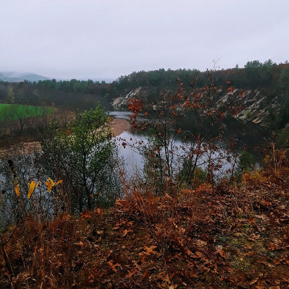
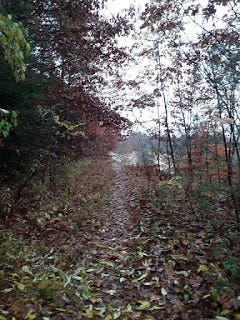
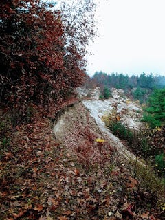
The area shown below is known as the Muchyedo Banks. I took the photo on a drizzly Halloween mid-morning, a few days before leaving New Hampshire. This spot is about a half-mile into the run that morning capped my streak of 365 days. I'm facing approximately northwest. The soil is a lot sandier than it looks, and the drop from where soil yields to sand down to the waterline perhaps more pronounced as well -- according to Google Earth, about 80 to 85 vertical feet. That's significant, not only in its own right but because it's about a quarter of the entire way down to sea level itself.
About 18 years ago, I wrote a story called Swing Time based mainly on this spot. In my imagined version, a giant oak tree has managed to spring from the soil near the base of the water and rise to a height of well over a hundred feet. This forms the basis for an appropriately scaled rope swing and an interesting hoax. I wrote a number of bad short stories in the late 1990s and early 2000s, but this one I am somewhat happy with even with the passage of so many years and writing lessons learned and attendant reasons to shit on anything I wrote a long time ago, or this morning.
I did have some fun rope-swing experiences as a kid, not terribly far from hear but on the northwest edge of town, at Broad Cove. It's surely for the best that that place gets a lot of public foot and bicycle traffic now.
The spot is a little over a mile west-northwest of the house where I spent the majority of my life in Concord, marked below with an H. Starting in about third grade, in 1978, I and my neighborhood friends used to ride our bikes west along Hoit Road across the interchange with I-93 and, often, to the nearest grocery store, which was in Penacook, close to a three-mile ride from my house.
Sometime in the past ten years, a long-overdue service station with a Dunkin' Do...a Dunkin' franchise was installed on Eli Whitney Drive, which in turn only started to exist on the 1990s, when Wheelabrator, a garbage-to-energy facility, built a plant and a giant waste emitter (can't call it a smoke stack, but it's the undisputed eyesore of the general northern Concord-Boscawen-Canterbury skyline) at what used to be Hannah Dustin Drive.
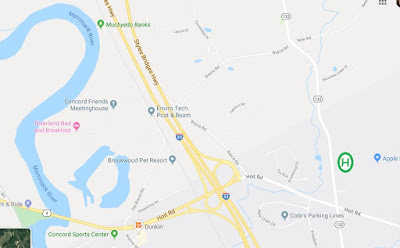
Before Interstate 93 was built in the late 1950s, Hannah Dustin Drive was the conduit from East Concord to Penacook. It ran southeast and intersected Mountain Road right at the spot where this unfolded. Portions of Hannah Dustin Drive west of I-93 are still paved even though they're only reachable on foot, and only then by people with an exploratory agenda. This strikes me as ectopic city tissue.
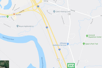
To get to where I started my Halloween run, I just drove from Hoit Road (U.S. Route 4 at this point) out Old Boyce Road, which becomes Riverland Road as it just to the west, which becomes Oxbow Pond Road as it makes a hard left turns south, toward a commercial (sort of) bed and breakfast.
Today, there's a small parking lot at this location. The trail leading north is part of a state-designated conservation area. When I was a kid, Old Boyce Road ended in an unnamed dirt lane paralleling the railroad tracks and leading, via trails, to the eastern bank of the Merrimack, close to the Route 4 bridge. I explored this area on numerous runs both in high school and in my return to Concord from about 1997 to around 2003, and once followed the dirt path along the tracks all the way north to West Road in Canterbury, neat Exit 18.
That exact trip would not be possible today. I took the photo below from close to the same spot I grabbed the photo above from, obviously having rotated about 45 degrees counterclockwise.
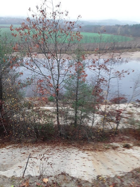
I was standing on the remains of a path that ran straight north-south without interruption within the past 20 years. Here is a view of that spot as one approaches it from the north. The path is simply gone. If you want to get around the space, that's easily done by using the railroad tracks just to the left. But it's a jarring reminder that some events that occur slowly in relation to human lifetimes, like the inexorable changing of a river's course, occur with astonishing speed in geologic time.
You may find it odd that anyone could be titillated by this stuff, but it makes for a lot of inexpensive fun. For example, when writing posts like these aren't enough of a way to waste time, I can make a personal adventure game out of exploring a familiar area using Google Earth Pro's ground-level navigation feature.
I wish I could be at the "New England" Championships this weekend; they're being held in the same place they were staged my senior year, Wickham Park outside Hartford, which is actually an unusual site. But if nothing else, I am back to making high-school-level competition my main running focus at the moment, and probably moving forward until the sport, the planet or all two are eradicated, preferably amid the clamor of a gleeful cosmic drunken belch. Some of the reasons for this should be obvious to you, while others are ore personal but not exactly recondite.

